

Birthday Flight (August
2006)
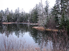
We lifted off from the
Hayward Airport in a Cessna 152 on a beautiful Sunday afternoon. We proceeded due North for a few
minutes paralleling highway 63 where, at 2,000, feet we could look in a
distance to see lake Superior and the Bayfield peninsula. We then turned 90 degrees to parallel
highway 77 and head East North East toward Clam Lake. We could immediately look into Round Lake just south of
highway 77 and then began to see a series of continuous lakes on both sides of the
highway all the way to Upper Clam Lake.
After Round lake came Big Spider lake (a chain of lakes), followed by
Lost Land Lake (Fish Fry resort), connected to Teal Lake with its great
Islands, and then lower Ghost Lake with Christy, Red Ike and the secret lakes
(Noble & Bentley) and than Lower Clam and finally our destination lake
(Upper Clam) with its connecting lakes to the North and West, Day Lake and
Chippewa Lake (headquarters of the West Fork of the Chippewa river). Also, when over Upper Clam, the
connected by stream lakes of Little Clam and Pole lake were readily in
view. Also, the land-locked,
Mclaren Lake with its few cabins was clearly in view. We dropped down to minimum altitude over Upper Clam and
circled our home and bay three times and saw Annemarie waving from the
deck. I took some aerial
view/pictures and we then headed back to Hayward following the West Fork of the
Chippewa as it flowed from Chippewa lake through Day Lake, and then Upper Clam
down through the lakes of Lower Clam, Cat tail, Meadow, Partridge Crop, and the
very large Moose Lake with many islands (homes on the islands) and then on to
the huge Chippewa Flowage (Big Chip). Just below Cat tail lake we could see the Torch River
entering the Chippewa and the wilderness lake named Kelly stood out as its
outlet ran into the Torch River.
It was extremely interesting
to see these beautiful lakes from the air, many of them connected by the West
Fork of the Chippewa River. Even
the large quiet lakes of Lost Land and Teal are connected to the Chippewa as
their Teal River connection flows into the Chippewa River. Also, Upper and Lower Ghost are also
connected by Ghost creek which eventually finds its way into the Chippewa river
just south of highway 77. The
remote wilderness lakes of Pole and the 2nd and 3rd lakes
of Little Clam also find their way into the Chippewa River through their
run-off streams into Upper Clam.
When flying over the Chippewa
Flowage, we saw where the West Fork of the Chippewa entered the Flowage and
combined size and power with the East Fork as it flowed out of the Flowage. The
East Fork of the Chippewa originates close to Glidden and we have canoed the
river in the areas of Pelican Lake, Bear Lake and down to GG. The various members of our family are
more familiar with the West Fork as we have canoed, in one-day segments, from
our lake, Upper Clam, all the way to the Chippewa Flowage. This is about a three-day trip.
As we flew over the Chippewa
Flowage, we again saw Round and Little Round Lakes and all the many lakes that
surround the town of Hayward including the Namekagon River, which widens and
forms Lake Hayward before making its way to the St. Croix river and eventually
to the Mississippi. At 2000 feet, one could see that Hayward is also surrounded
by Lakes and was blessed by its location in the Namekagon river valley/basin.
This trip brought new meaning
to the term, the Chippewa river Basin as it originates up in our Clam Lake area and
continues South until it eventually joins the giant Mississippi and makes it
way to the Gulf of Mexico. Clam
Lake is not only in the heart of the Chequamagon National Forest (now over 1
million acres of public land) but is also at the origin of the upper Chippewa
River basin. The
flight brought out the interconnectivity of these natural resources and how
fortunate we are to be able to enjoy them. The over-flight trip also revealed how much the Chippewa
river meanders in its early path before it gathers speed and size as it flows
Southward (it almost meets itself in some of its meanders). I could pick out the deep pools at the
inside edges of these meanders where one knows that the walleyes and muskies
lie in wait for their next meals.
I also found where the West Fork of the Chippewa flows close enough to
Highway 77 near Ghost Creek that will allow us to access the river for future
easy river trips to Moose lake and its islands.
I thank you all for arranging
and making possible this very enjoyable and interesting flight. It was a wonderful and much appreciated
gift.
Love, Dad/Dad Stuebe/The POD ( Papa/Opa/Dad)
Foot Note: The
Pilot, Mike Wagner, was a very interesting person. Born in Milwaukee, he attended Purdue University and majored
in aviation and graduated as a Pilot and went on to receive his MS in Electrical
Engineering. He took a job with the Environmental Protection Agency (EPA) in
the Milwaukee area and applied for and received a transfer up to Hayward to
work in the Agency. He currently
resides in the Winter area on an old family plot of land and works for the EPA
and moon lights as an instructor pilot/tour pilot and rents his two planes
(Cessna 152 and 4 passenger Cessna 172).
I helped him push the Cessna 152 into the hanger and told him of my 40
plus hours as an Air Force pilot trainee.
The take off and landing in the single engine Cessna 152 brought back
memories of my time in the Air Force T-34 trainer aircraft. It was a nice
experience and he offered me a chance to fly the Cessna but I declined the
offer, as I was more interested in concentrating on the lakes and terrain
below.
Entered into my Diary on this
day- 28 August 2006

No comments:
Post a Comment